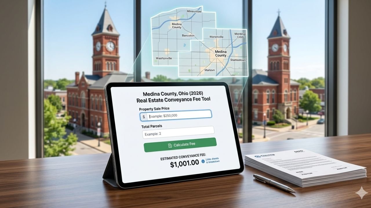
If you need zoning information in Medina County, use only official sources. As of February 27, 2026, zoning details are available through the County GIS portal, the City of Medina Official Zoning Map (ratified November 26, 2025), and the Planning Commission meeting schedule for pending updates. Because some areas follow home-rule authority, always confirm parcel details through the county auditor before building, buying, or splitting land.
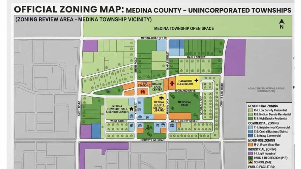
Official Zoning Maps of Medina County Townships
Zoning maps show district boundaries using color-coded categories. Each color represents residential, commercial, industrial, or agricultural designations. These maps are essential tools for understanding where development can occur.
Every township maintains zoning oversight within county guidelines. Key township zoning maps include:
Key Township Zoning Maps
- Brunswick Hills Township
- Hinckley Township
- Lafayette Township
- Montville Township
- York Township
- Wadsworth Township
- Granger Township
- Guilford Township
- Harrisville Township
- Homer Township
- Liverpool Township
- Medina Township
- Sharon Township
- Spencer Township
- Westfield Township
Each township may have specific zoning resolutions or local amendments. Always confirm district rules directly before making development decisions.
Zoning in Medina County
Zoning controls how land can legally be used. It protects neighborhoods, supports business growth, and keeps development organized. In simple terms, zoning tells you what can be built and where.
There are four primary land-use categories:
- Residential – homes, apartments, townhouses
- Commercial – offices, retail stores, service businesses
- Industrial – manufacturing, warehouses, production facilities
- Agricultural – farmland and rural land uses
Before purchasing property or starting construction, confirming zoning is critical. A parcel zoned agricultural cannot automatically be used for commercial development. Checking zoning early helps you avoid permit denials, redesign costs, and legal delays.
Township and City Zoning Maps and Essential Planning PDFs
The Medina County Department of Planning Services and the City of Medina Planning Department provide comprehensive PDF resources for all planning, zoning, and subdivision needs. Accessing these documents is the first step toward ensuring project compliance and streamlining your application process.
| Document | Purpose |
|---|---|
| Minor Subdivision (Lot Split) Application | Required for dividing property into 5 or fewer lots without new streets. |
| Major Subdivision Application | Submit for large-scale developments (6+ lots) requiring new infrastructure. |
| Preliminary Plan Checklist | Essential requirements for the initial review of major subdivisions. |
| Final Plat Checklist | Final technical requirements before recording a plat with the County. |
| Zoning Variance Application (BZA) | Request exceptions for setbacks, height, or area requirements. |
| Conditional Use Permit Application | For land uses that require special discretionary approval. |
| Zoning Reclassification (Rezoning) | Request a formal change to the zoning district of a property. |
| Certificate of Zoning Compliance | Verification that a proposed building or use meets code. |
| Site Plan Review Application | Required for new commercial, industrial, or multi-family construction. |
| Written Notice of Appeal | Formally challenge a decision made by the Zoning Inspector. |
Get All PDFs & Planning Resources
How to Check Your Property Zoning
Checking zoning in Medina County is straightforward:
- Visit the official county GIS mapping portal
- Enter your parcel number or property address
- View the displayed zoning classification
- Contact your township zoning inspector for confirmation
Because zoning updates may be pending or under review, verifying directly with local officials ensures complete accuracy.
Planning Commission Meetings & Public Hearings
Planning Commission meetings are open to the public and follow an official 2026 schedule. Subdivision applications, zoning amendments, and land-use changes are reviewed during these sessions.
Participation in these meetings promotes transparency and informed decision-making.
Minor Subdivisions (Lot Splits)
Minor subdivisions are commonly known as lot splits. These apply when a property owner divides land into smaller parcels without creating a large development.
What Qualifies as Minor Subdivision
A subdivision typically qualifies as minor when it involves:
- Fewer than five lots
- No major roadway extensions
- Minimal infrastructure impact
These are often used for residential parcel divisions or small land transfers between adjoining properties.
Application Requirements
To apply for a lot split, you generally need:
- A completed lot split application form
- A detailed site plan or survey drawing
- Confirmation of township zoning compliance
Submitting accurate documents ensures faster review and avoids unnecessary delays.
Major Subdivisions
Major subdivisions involve larger development activity and require a more structured review process.
When Major Review is Required
A subdivision is considered major when it includes:
- Five or more lots
- New road construction or infrastructure expansion
- Utility system extensions or significant land changes
These projects undergo detailed technical and regulatory evaluation.
Review & Approval Process
The approval process includes:
- Submission of a preliminary plan
- Review against county standards
- Preparation of a final plat
- Formal approval from the Planning Commission
Only after full compliance is verified can recording and development move forward.
Zoning Code & Ordinance Background
Medina County townships operate under adopted zoning resolutions. The City of Medina follows its ratified zoning ordinance and Comprehensive Plan framework.
Zoning codes outline:
- Permitted and conditional land uses
- Building setbacks and height limits
- Density regulations
- Parking and infrastructure requirements
Amendments to zoning codes require formal application, public notice, and official approval. This structured process protects both property owners and community standards.
Role of the Zoning Inspector
The Zoning Inspector plays a critical role in enforcing regulations. Responsibilities include:
- Reviewing zoning permit applications
- Processing variance requests
- Conducting compliance inspections
- Investigating zoning violations
Before construction begins, most projects require a zoning certificate confirming compliance with district regulations. This step prevents costly corrections later.
Conclusion
Zoning and planning in Medina County require attention to official sources, township rules, and county review processes. By using the GIS portal, confirming parcel data, and consulting planning authorities, you protect your investment and avoid unnecessary delays. Proper zoning verification is not optional it is the foundation of safe, legal, and successful property development in 2026.
FAQs
Where can I find the official Zoning Map?
- City of Medina: You can view the current City Zoning Map on the city’s official website. It details specific districts such as residential, commercial, and industrial.
- Townships: For unincorporated areas, you should refer to individual township maps, such as the Medina Township Zoning Map.
How do I apply for a zoning change or variance?
Applications for a Zoning Map Amendment or a Variance (such as area or use variances) must be submitted to the Medina Planning & Zoning Department. These requests are typically reviewed by the Board of Zoning Appeals or the Planning Commission.
What are the meeting dates for 2026?
The 2026 Boards and Commission Meeting Schedule is available online. Public meetings for the Medina County Planning Commission (MCPC) are held monthly, with upcoming sessions like the March 4, 2026 meeting involving plan reviews for Montville and Medina Townships.
Is there a cost for planning applications?
Yes, all applications are subject to the city’s Planning Fee Schedule, which covers costs for site plans, conditional use permits, and subdivision reviews.